Drone
Drone Photography for Hotels and Vacation Properties — How Aerial Frames Sell the Place
In this article
- Why an aerial frame shows what a ground photo cannot
- The property in context: sea, beach, greenery and infrastructure
- Drone photography for hotels and resort complexes
- Aerial frames for Airbnb and vacation rentals
- What I shoot from the air
- When the straight-down frame works hardest
- Mavic 4 Pro and Avata 360 — different tools for different visual storytelling
- Safety, regulations and flight planning
- What professional aerial photography costs
- Book drone photography for your hotel or property
I shoot aerial photography for hotels, vacation properties and tourism businesses on the Black Sea coast and across Bulgaria — legally, as a registered operator holding EU UAV Open A1/A3 + PDRA-S01. This article shows what drone photography actually gives a property: the context no ground-level photo can show — how close the sea is, the greenery, the infrastructure and the scale of the place. Every frame below is my own real aerial work.
If you run a hotel, a resort complex or a vacation rental, you probably already have decent interior photos. What they don't answer is every guest's first question: where is this, and what surrounds it?
Why an aerial frame shows what a ground photo cannot
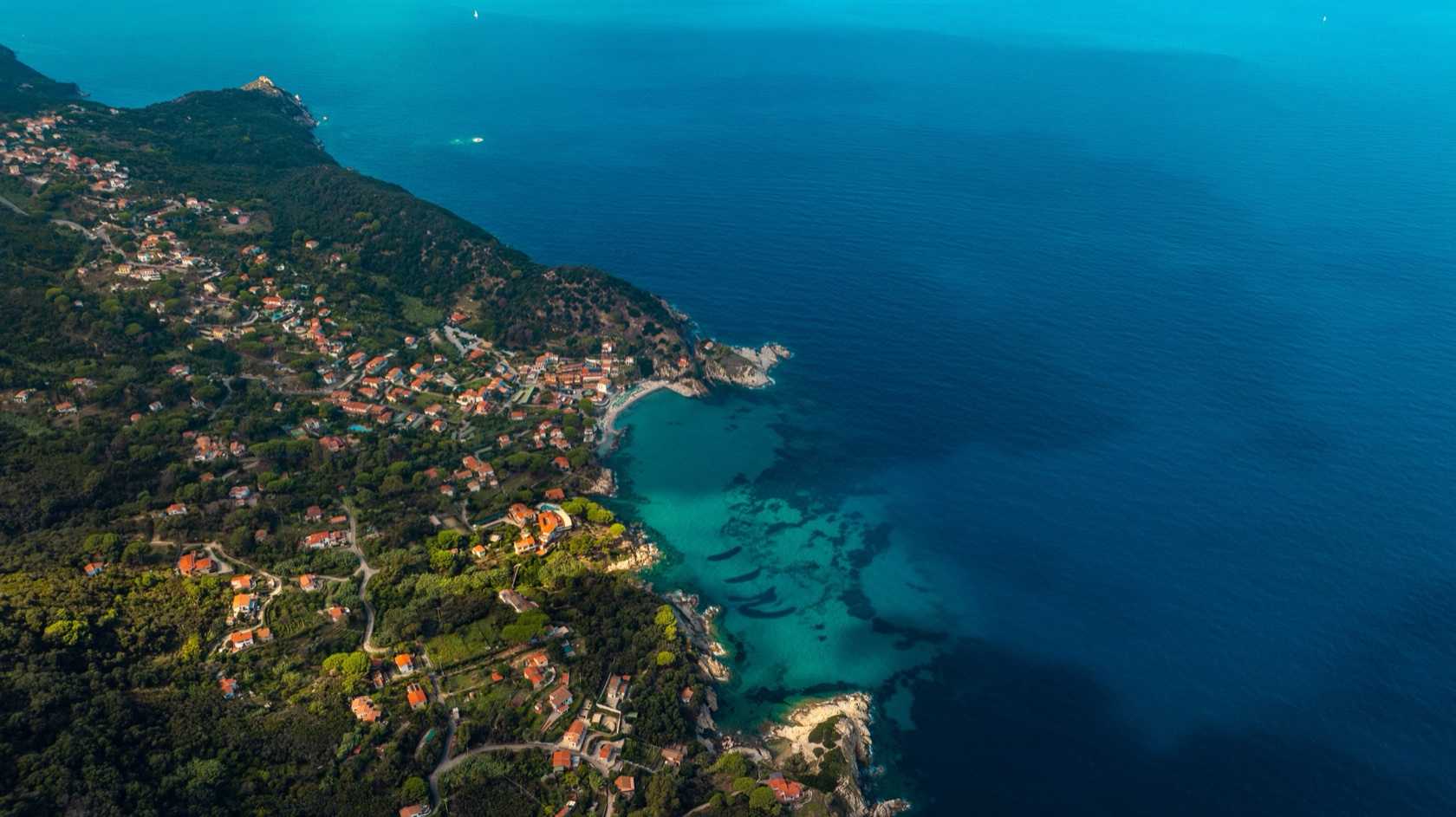
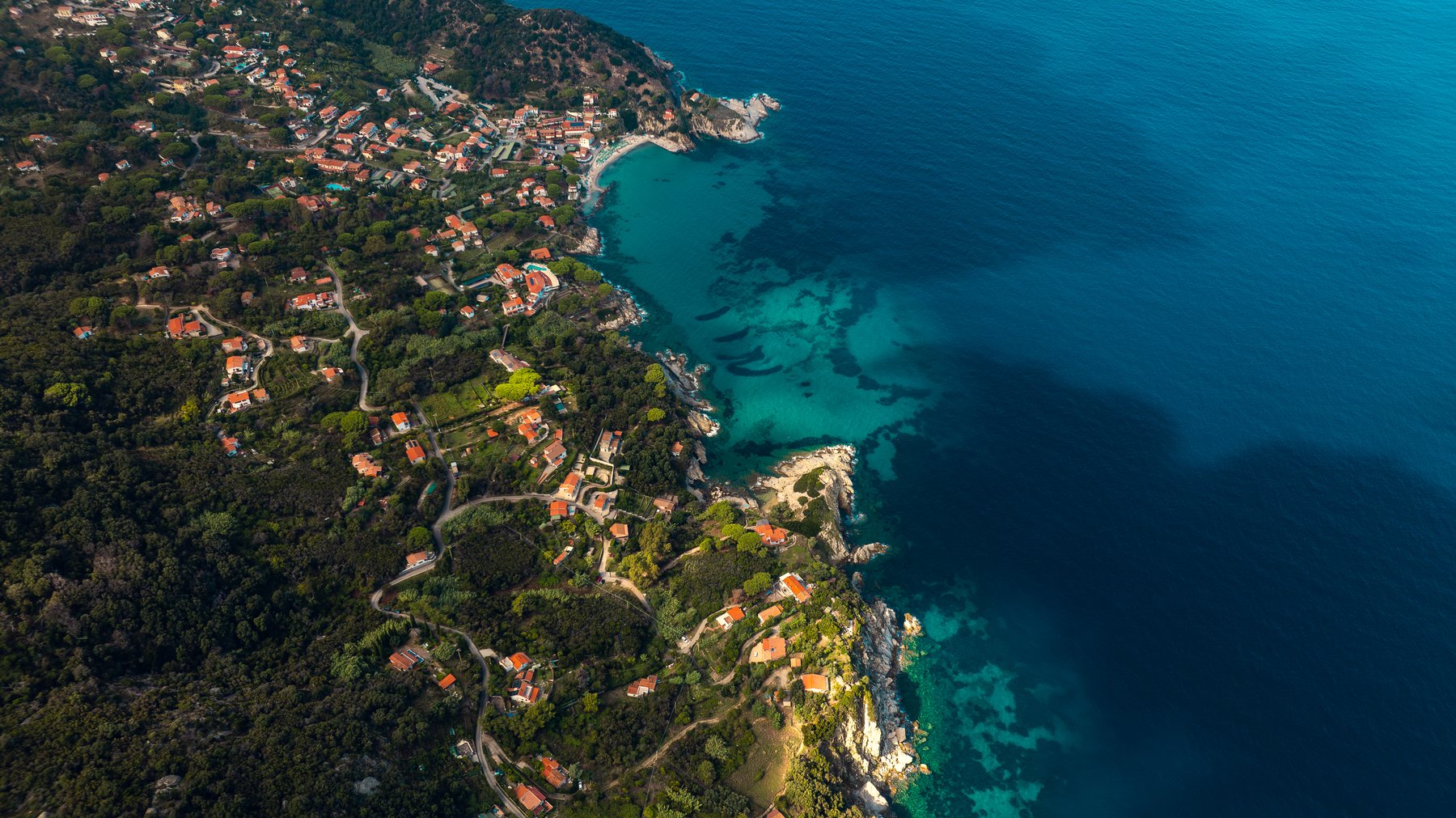
From the ground you show the building. From the air you show the place. A guest doesn't book a room — they book a location: how far the beach is, whether there's greenery, what the neighbourhood feels like, what the terrace will look out on.
That's why the aerial frame works differently from everything else in a listing. It answers the question "where" without a single word.
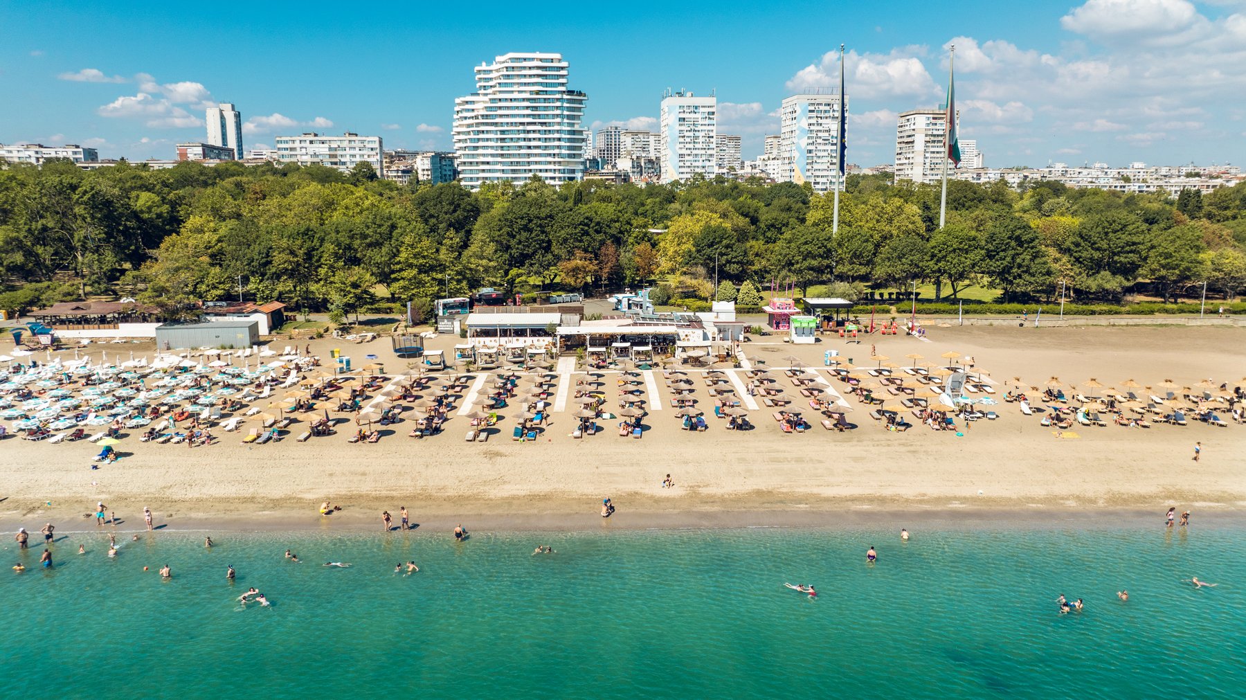
The property in context: sea, beach, greenery and infrastructure
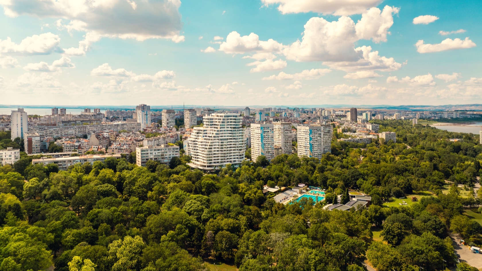
The strongest aerial frame for a property is rarely the one where the building looks biggest. It's usually the one where the building is part of a context: the beach strip, the park beside it, the street leading to the sea. One frame from the right altitude and angle tells the full geography of a place.
And that's the frame most listings are missing: everyone shows the room, few show the place.
Drone photography for hotels and resort complexes
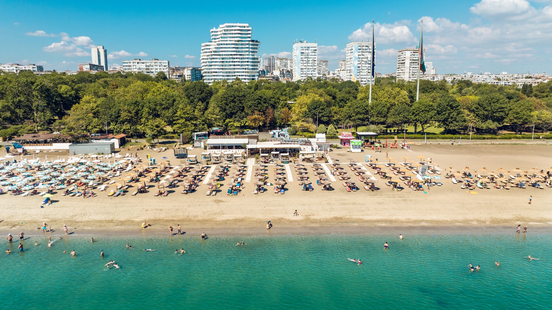
For hotels the aerial set usually covers the facade in context, the pool area, the beach access and panoramas of the surroundings. If the hotel has its own beachfront or a bar on the shore, a straight-down frame turns it into a recognisable visual asset.
These frames work on the hotel's website, on booking platforms and in ad campaigns — one flight produces material for all three.
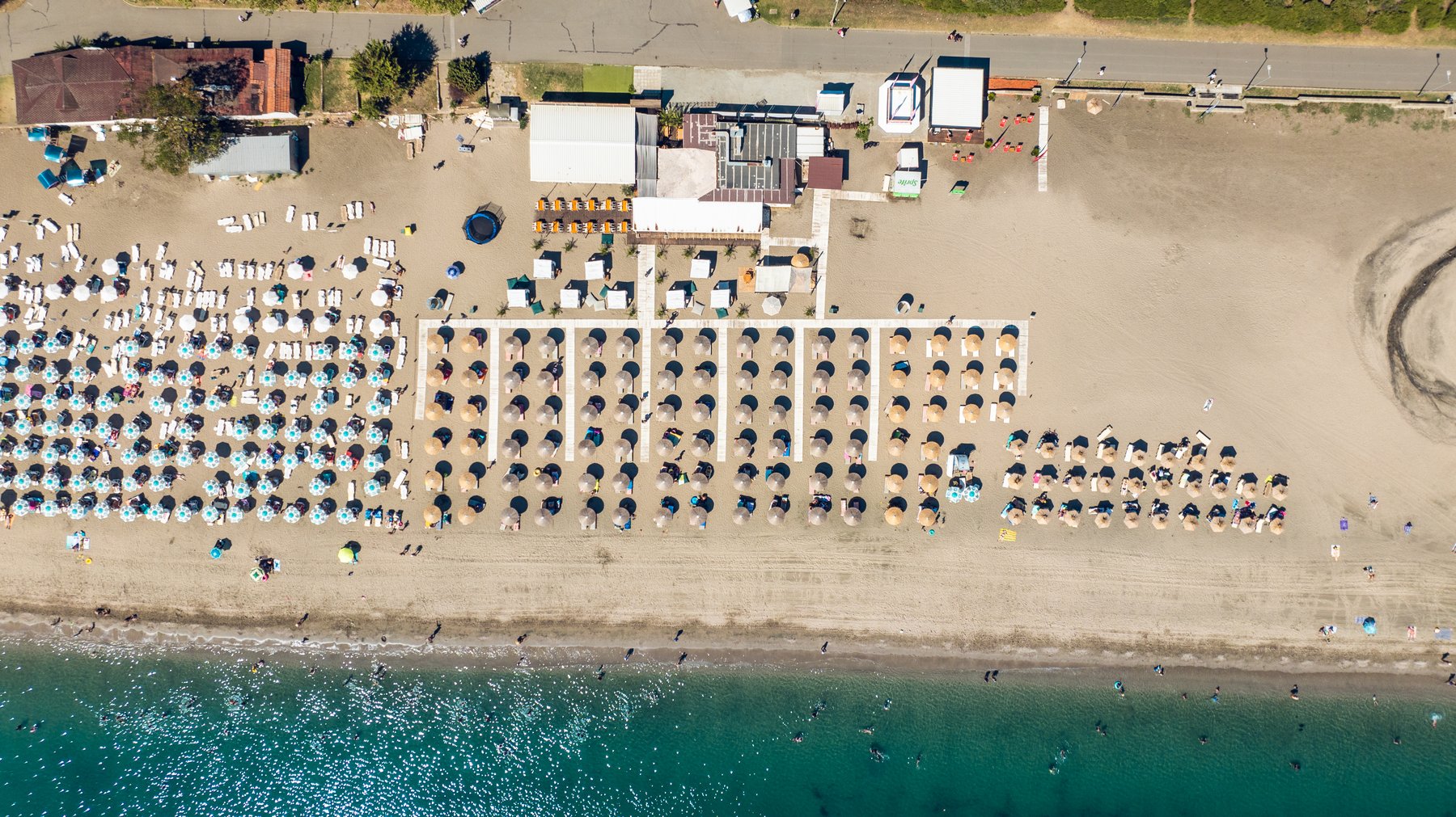
Aerial frames for Airbnb and vacation rentals
For an apartment or guest house, the aerial frame sells the position: the distance to the beach, the quiet street, the yard, the view. That's information a guest otherwise pieces together from maps and reviews — and can see in a single frame instead.
The best results come when the aerial set is combined with interior photography — context from outside, honest spaces from inside. Together they are the complete answer a listing needs.
What I shoot from the air
Establishing shots of the property in context, straight-down top-down frames of beach zones and pools, panoramas of the surroundings in several directions and, on request, a short video of up to 60 seconds for listings and social media.
I plan every flight in advance: I check the zone, the light and the wind, and I know which frames I'm after before the drone takes off.
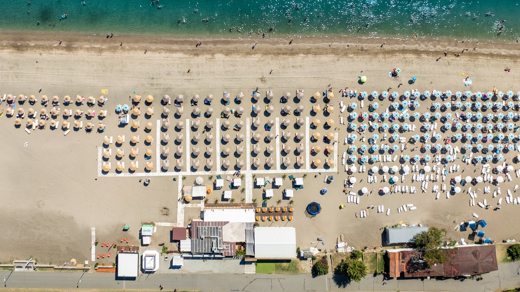
When the straight-down frame works hardest
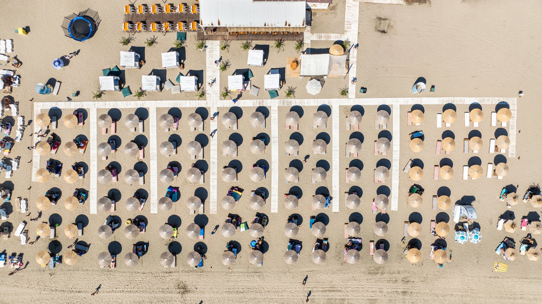
The top-down frame turns a beach into graphics: the rows of umbrellas, the waterline, the walkways. It looks like nothing else in a listing, which is exactly why it stops the eye — on a booking platform, on social media, in print.
It works best with orderly infrastructure and clear geometry — exactly what hotel and resort beach zones have.
Mavic 4 Pro and Avata 360 — different tools for different visual storytelling
I fly two drones. The DJI Mavic 4 Pro — Hasselblad 4/3 sensor, 100MP stills, 6K ProRes video — is the main machine for property work: stable, clean frames and smooth movements. The Avata 360 delivers dynamic fly-throughs and immersive angles — less often needed for properties, but strong for campaigns and social media.
If you're curious how the two drones differ in real work, I've compared them in detail.
Safety, regulations and flight planning
Drones in Bulgaria fly under the European (EASA) rules: the Open category up to 120 metres, operator registration and third-party insurance for commercial work. I fly with EU UAV Open A1/A3 and Specific PDRA-S01 for operations beyond the Open category.
Important for the coast: because of Burgas Airport, a large part of the shoreline sits in a restricted zone. Flight permits there are filed 14 days in advance — so the aerial conversation should start early, not a week before the campaign.
In wind above 10 m/s and in rain we don't fly — we plan a backup day. That's part of professional planning, not a surprise on shoot day.
What professional aerial photography costs
Aerial work starts from €350 — up to 3 hours of flying at one location, 15+ edited frames and an optional 60-second video. Current packages are on the pricing page.
If the location is in a restricted zone, the permit is part of the service — I file the application; you only pick a date 14 days ahead.
Book drone photography for your hotel or property
I work with hotels, restaurants, real-estate agencies and vacation-rental owners in Burgas and across the country. Tell me the place and the goal — listing, website or campaign — and I'll check the zone, plan the flight and propose a specific set of frames.
Get in touch — I reply with a concrete plan and timeline.
Ready to plan?
See what the packages include and where the prices start.